Kyushu Volcano Road Trip: Aso, Kirishima and Sakurajima in 4 Days (November 2026 Alert Levels)
By Kyushu Travels Team · Updated · 16 min read
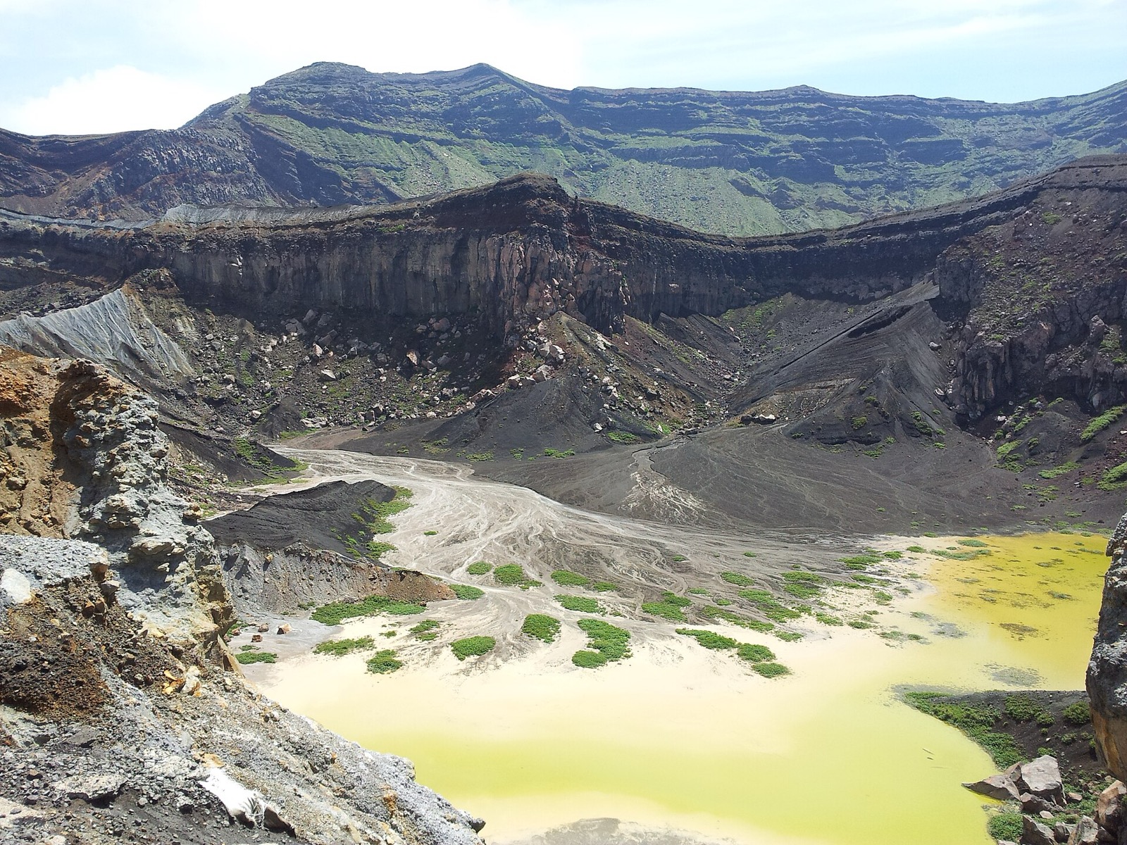
A Kyushu volcano road trip is the one drive in Japan where the ground is doing something every day. The Japan Meteorological Agency (JMA) lists 17 active volcanoes across Kyushu’s seven prefectures, 11 of them in Kagoshima, and three of the big ones line up along a single four-day, one-way route: the Aso caldera, the Kirishima range with Ebino Kogen, and Sakurajima across the bay from Kagoshima. This plan runs from Kumamoto Airport to Kagoshima Airport, with each volcano’s JMA alert level as checked on 3 November 2026, what that level closes on the ground, and what you can still see. It is the first of our Kyushu itineraries, and it links the Kumamoto, Miyazaki and Kagoshima guides.
Levels change without notice. Before each day, open JMA’s volcano map; everything below tells you what each level means for the road you are on.
The loop at a glance
| Day | Route | Night | Volcano and JMA level (3 Nov 2026) | What is open |
|---|---|---|---|---|
| 1 | Kumamoto Airport, Daikanbo, Aso Shrine, Kusasenri, summit plaza | Uchinomaki Onsen or Kurokawa Onsen | Aso, Level 2 (crater-area restriction, about 1 km) | Park road to the summit plaza, Kusasenri, museum; the crater rim is closed |
| 2 | Kyushu Expressway to Ebino, Ebino Kogen, Kirishima Onsen | Kirishima Onsen | Ebino Kogen (Iozan), Level 1; Shinmoedake, Level 2 (about 2 km) | Eco Museum Center and the pond walk, with sections closed; prefectural road 1 past Iozan open weekends only |
| 3 | Kirishima Jingu, Takachiho-gawara, Sakurajima by the 1914 lava, ferry | Kagoshima | Sakurajima, Level 3 (entry restriction, 2 km) | Kurokami torii, Arimura lava walk, Yunohira observatory, the ferry |
| 4 | Shiroyama, Sengan-en, Kagoshima Airport | Everything |
Kyushu’s active volcanoes today, and which you can visit
JMA’s list of active volcanoes has 17 entries in Kyushu’s seven prefectures. Oita has Kuju, Tsurumi-Garan (above Beppu) and Yufudake. Kumamoto has Aso. Nagasaki has Unzen and the Fukue group in the Goto Islands. Kirishima straddles Miyazaki and Kagoshima. Kagoshima alone has 11: Kirishima, Sakurajima, Kaimondake, Ikeda-Yamagawa near Ibusuki, Yonemaru-Sumiyoshiike, Wakamiko under Kinko Bay, Satsuma-Iojima, Kuchinoerabujima, Kuchinoshima, Nakanoshima and Suwanosejima. Not all of them carry alert levels; Kaimondake and Yufudake, for example, are monitored but have no level operation.
The levels run from 1 to 5 (JMA’s explanation): 1 means remember it is an active volcano, 2 closes an area around the crater, 3 closes the mountain to visitors, 4 tells older and vulnerable residents to evacuate and 5 evacuates everyone. On the ground the difference between 2 and 3 is the difference between seeing a crater and seeing a car park, which is why this plan carries the level for each stop.
On 3 November 2026 the route looks like this:
- Aso: Level 2. Lowered from 3 at 16:00 on 1 September 2026; entry is banned within about 1 km of Nakadake’s first crater because of ballistic rocks and gas (JMA notice).
- Kirishima, Shinmoedake: Level 2. Lowered from 3 at 11:00 on 17 October 2025; large rocks are the risk within about 2 km of the crater and pyroclastic flows within about 1 km (JMA notice). The peak has no tourist road, so for a driver this means nothing closes except the summit trails.
- Kirishima, Ebino Kogen (Iozan): Level 1 since 6 December 2023, with hot water and mud still possible within about 100 m of the crater and the fumarole zone 500 m to its west; local entry bans apply (JMA status page).
- Sakurajima: Level 3 since 27 July 2022; entry is banned within 2 km of the Minamidake summit crater and the Showa crater (JMA’s Sakurajima page). Every road and observatory described below sits outside that circle.
- Kuju, Unzen, Tsurumi-Garan, Kirishima’s Ohachi and Ohataike: Level 1. None of them is on JMA’s warning list today.
- Off the route: Satsuma-Iojima and Suwanosejima, both islands south of Kagoshima, are at Level 2.
Before you go: licence, a one-way car, the expressway pass, gas and ash
Licence. Japan accepts an International Driving Permit issued under the 1949 Geneva Convention, and licences from Taiwan, Switzerland, Germany, France, Belgium and Monaco with a Japanese translation from JAF (JAF’s driving-in-Japan page). If your home licence fits neither, skip to the rail version below.
A one-way car. Pick up at Kumamoto Airport (KMJ) and drop at Kagoshima Airport (KOJ): the route never doubles back, and driving a car back to Kumamoto costs a day. On DiscoverCars’ Kumamoto Airport page, set the drop-off to Kagoshima Airport; any one-way fee the supplier charges appears in the quoted price before you pay, so you can compare it with the cost of the extra day.
Kyushu Expressway Pass. NEXCO West’s flat-rate pass for foreign visitors in rental cars costs ¥6,200 for 2 days, ¥8,400 for 3 and ¥10,600 for 4, works through an ETC card from a participating rental company (Times and Nissan among them), and is on sale until 31 March 2027 (NEXCO West). This trip uses the expressway on Day 2 and the airport runs; price it against the tolls for your car.
Gas. Kumamoto Prefecture’s Aso climbing page (updated 2 September 2026) is blunt: people with asthma, bronchial disease, heart disease or who feel unwell must not go up to the crater area at all; everyone else should carry a towel or handkerchief and a close-fitting mask, and watch the wind, with an east wind the one to be careful of (Kumamoto Prefecture). The same rule of thumb holds at Iozan.
Ash. Sakurajima drops ash on whichever side the wind favours. JMA publishes an ash-fall forecast on the same map as the levels. Keep the car’s windows up in a fall, clear the glass with water rather than dry wipers, and have data on your phone for the alerts: our Japan eSIM guide covers the options, and the rest of the practical pages are on the travel essentials hub.
Day 1: Kumamoto Airport to the Aso caldera
From Kumamoto Airport it is about an hour’s drive to the Aso summit area and about 1 hour 15 minutes to Daikanbo, according to the airport guide on travelist (April 2026). You are driving into one of the world’s largest calderas: about 18 km east to west, 25 km north to south and 350 square kilometres, per the Aso UNESCO Global Geopark. It was carved by four giant pyroclastic-flow eruptions between roughly 270,000 and 90,000 years ago (Ministry of the Environment, Aso geopark page), and towns, rice fields and a railway line now sit on the floor.
Do the rim first. Daikanbo, on the north wall, is the viewpoint where the five central peaks line up in one profile. Drop down to Aso Shrine, whose two-storey romon gate collapsed in the 2016 Kumamoto earthquake; the gate and the other five Important Cultural Properties were rebuilt first, and the shrine held the completion ceremony for the last of the works on 20 December 2024, eight years and eight months after the quake (Kumamoto Nichinichi Shimbun). Then take the road up through the grasslands past Komezuka, the small, perfectly dimpled scoria cone, to Kusasenri, the grassy old crater floor with ponds and grazing horses, and the Aso Volcano Museum across the car park (9:00 to 17:00, last entry 16:30, per the museum; admission ¥1,300 for junior-high age and up, per the museum’s guide page). Its live camera of the crater is the honest way to see what you would have seen.
What Level 2 means at the top. The Aso Volcano Disaster Prevention Council’s site (aso-volcano.jp) carries the rules. The toll road, the Aso Park Road, runs 8:30 to 17:30 in November with the gate shut at 17:00, and 9:00 to 17:00 from 1 December to 19 March with the gate shut at 16:30; the toll for an ordinary car is ¥1,000 (Kumamoto Nichinichi). At Level 2 the road takes you to the summit plaza, reachable again since 09:00 on 2 September, but entry within about 1 km of the crater is banned, so the rim walk and the crater shuttle are closed. Crater viewing has been off for much of 2026: a sightseeing helicopter with three people on board went down inside Nakadake’s first crater on 20 January 2026 (Kumamoto Nichinichi), and JMA raised Aso to Level 3 on 14 August before lowering it to Level 2 on 1 September. Even during the Level 3 spell, Kusasenri’s car park, its restaurants and the museum stayed open, because the closure began beyond them (KAB, 14 August 2026). So the day works at any level you are likely to meet; only the last kilometre changes.
Night. Uchinomaki Onsen is the hot-spring quarter on the caldera floor near Aso Station, with the peaks in view from the baths; Kurokawa Onsen, north over the rim, is the famous ryokan village and costs more. Compare Uchinomaki on Booking.com and Kurokawa on Agoda.
Day 2: Over to Kirishima: Ebino Kogen and Kirishima Onsen
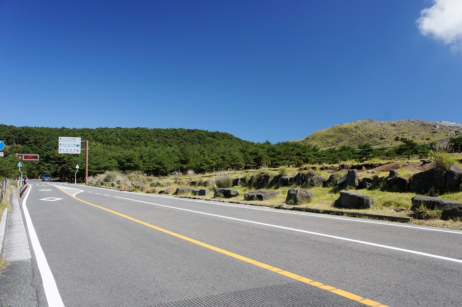
Leave the caldera by the Kyushu Expressway and run south to Ebino, then climb to Ebino Kogen, the 1,200 m plateau on the Miyazaki side of the Kirishima range. The Ebino Eco Museum Center is the hub: the pond walk to the three crater lakes, Byakushi-ike, Rokkannon-mi-ike and Fudo-ike, starts there, and so does the trail up Karakunidake, the range’s highest peak. Iozan, the bare sulphur hill beside the road, is at Level 1, but JMA still warns of hot water and mud within about 100 m of its crater and of the fumarole zone 500 m to the west, and the municipalities keep their own no-go zones; sections of the pond walk have been closed because of the gas, so ask at the centre which loop is open before you set off.
The road past Iozan, and why the day of the week matters. Prefectural road 1, the direct road from Ebino Kogen over to the Kirishima hot-spring side, passes right under Iozan, and it has been running on a weekly notice. The one posted by the Kirishima City Tourism Association on 29 October 2026 opened the section from near the Koshikidake trailhead to the junction with prefectural road 30 on Saturdays and Sundays only, 9:00 to 17:00, roofed vehicles only, for 31 October and 1 November, and warned that it closes for volcanic activity or weather (the notice). Check the association’s news page for the current week. On a weekend you can drive straight through to Kirishima Onsen; on a weekday, do Ebino Kogen as an in-and-out from the Ebino side and go round by the expressway, which adds driving but costs nothing in views.
Night. Kirishima Onsen, the string of hotels and ryokan on the Kagoshima slope of the range, with steam rising from the roadside. Compare it on Booking.com.
Day 3: Kirishima Jingu and Takachiho-gawara, then Sakurajima by the 1914 lava road
Kirishima Jingu enshrines Ninigi-no-Mikoto, the grandson of the sun goddess who, in the myth, came down from heaven onto the peak of Takachiho behind it. The shrine’s own history says it was repeatedly destroyed by the mountain: the monk Shoku moved it to Takachiho-gawara in 950, another eruption wrecked it in 1234, it was rebuilt in 1484, and the present vermilion halls were given in 1715 by Shimazu Yoshitaka, the 21st head of the Satsuma clan; the main, offering and worship halls became a National Treasure on 9 February 2022 (shrine history). The office is open 8:00 to 17:00 and parking is free for 500 cars (access page).
Drive up to the Takachiho-gawara Visitor Center (9:00 to 17:00, closed Mondays or the next day after a holiday, paid parking for 150 cars, per Kagoshima Prefecture), the old shrine site and the trailhead for Takachiho-no-mine. Its crater, Ohachi, is at Level 1 today, so the trail is open; the sign at the centre has the day’s status.
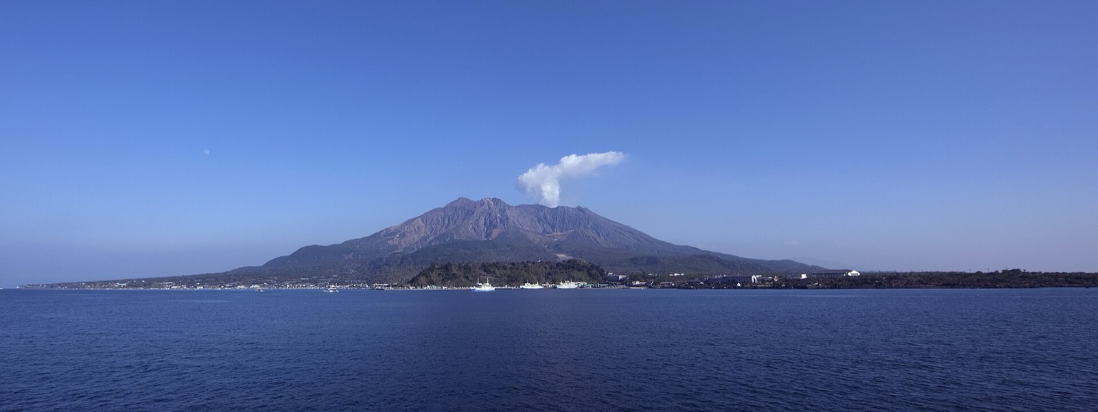
Then head down to Kinko Bay and around its eastern shore onto Sakurajima, which is no longer an island. The Taisho eruption began at about 10:00 on 12 January 1914 on the western flank, lava started flowing on the 13th, and by 29 January it had filled the Seto strait and joined Sakurajima to the Osumi Peninsula; 58 people died (Cabinet Office disaster report). The road in from the peninsula crosses that lava.
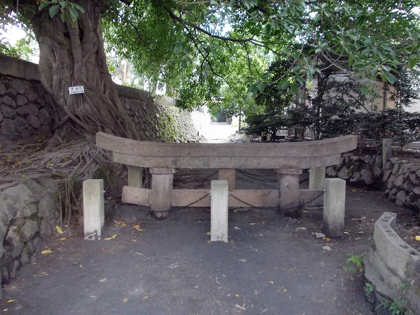
First stop, on the east coast: the Kurokami buried torii. Pumice and ash fell about 5 m deep on Kurokami in 1914; the villagers rebuilt on top, and chose to leave the shrine gate and one house’s gatepost unexcavated as a record of what had happened, which is why the gate has been a prefectural natural monument since 28 April 1958 (Kagoshima Prefectural Museum). The torii was 3 m tall; about 1 m, the crossbeam, shows (Kurokami torii listing). Continue round the south coast to the Arimura Lava Observatory, where a walkway crosses the 1914 lava field under the summit, and then up to the Yunohira Observatory at 373 m, the highest point on the volcano the public can reach (Yunohira listing). All three are outside the 2 km zone; the plume, when there is one, is the Level 3 part.
The ferry. From Sakurajima Port the city ferry crosses to Kagoshima Port in about 15 minutes, up to 20 in rough weather, with 94 sailings on weekdays and 104 at weekends (timetable). Fares, from the city’s fare page updated 14 October 2026: ¥250 per adult and ¥130 per child; a car under 3 m ¥1,280, 3 to 4 m ¥1,700, 4 to 5 m ¥2,350, 5 to 6 m ¥2,630, each including the driver. Pay at the ticket office, the gates or the toll booth by cash, card or IC card. Since 1 October 2025 there are no sailings between midnight and 4:00 (city notice), so don’t plan a late crossing.
Night. Kagoshima, around Tenmonkan for the restaurants or Kagoshima-Chuo for the station: hotels around Tenmonkan on Booking.com.
Day 4: Kagoshima, and the drop-off at the airport
Two views of the volcano from the city side, then the car goes back. The Shiroyama Observatory, on the wooded hill behind Tenmonkan, lines up the city, the bay and Sakurajima in one frame and is the standard morning photograph. Sengan-en, the Shimazu lords’ villa garden on the shore to the north, uses Sakurajima as its borrowed scenery; it is open 9:00 to 17:00 every day of the year, and the Shoko Shuseikan museum beside it belongs to the Meiji industrial World Heritage listing (Sengan-en). Kagoshima Airport is about 30 km north of the city centre, per DiscoverCars’ Kagoshima Airport page, so leave the garden with the return time in mind.
When the level changes: ash days and Plan B
| If | Then |
|---|---|
| Aso goes to Level 3 | The park road closes 2 km out, but Kusasenri, its restaurants and the museum stayed open through the August 2026 spell. Watch the crater on the museum’s camera and keep the day. |
| Prefectural road 1 is closed on your Ebino day | Do Ebino Kogen in and out from the Ebino side, then the expressway to Kirishima Onsen. |
| Sakurajima is dropping ash on the city | Reverse the order: do the Osumi side and the island in the morning if the forecast favours it, or take the views from Shiroyama and Sengan-en and skip the crossing. The JMA ash-fall forecast decides. |
| Any volcano reaches Level 4 or 5 | Follow the municipality’s instructions and leave the area. The trip still works with the stop removed. |
Without a car: the rail and bus version
The JR Kyushu Rail Pass, Southern Kyushu, costs ¥12,000 for 3 days (child ¥6,000), covers Kumamoto and everything south of it including Oita, takes in the Kyushu Shinkansen between Kumamoto and Kagoshima-Chuo, and includes 6 free seat reservations; it is for temporary visitors on a foreign passport only. The All Kyushu pass is ¥22,000, ¥24,000 and ¥26,000 for 3, 5 and 7 days (JR Kyushu). With the Southern pass the loop becomes: Kumamoto to Aso Station on the Hohi line, then the Sanko bus up the mountain, ¥1,000 to Kusasenri or the summit terminal, per Bus-trip’s April 2026 check (confirm with Sanko Bus); back to Kumamoto and the shinkansen to Kagoshima-Chuo; a Nippo-line train to Kirishima-Jingu Station and the bus to the shrine; and the ¥250 ferry to Sakurajima, where the Island View bus loops the sights for ¥230 a ride or ¥500 for a day pass (Kagoshima tourism). Ebino Kogen is the one stop this version loses.
Buy the JR Kyushu Rail Pass on Klook →Can’t drive here? Tours by volcano
If your licence doesn’t work in Japan, or you would rather not drive mountain roads, each volcano has a bookable day. Check each listing for its current route, since operators change stops with the alert level.
- Aso from Fukuoka: a day tour to Kamishikimi Kumanoimasu Shrine, Kusasenri and Kurokawa Onsen on Klook.
- Kirishima from Kagoshima: a small-group day to Kirishima Jingu, Takachiho Farm and Maruo Falls on Klook.
- Sakurajima: a half-day small-group volcano tour by the Island View bus on Klook. Everything bookable we cover is on the tours hub.
Where to stay
Three nights, three kinds of hot spring: a caldera-floor onsen or a ryokan village on Day 1, a mountain hot-spring resort on Day 2, a city on Day 3. The booking links above are the ones we would use; the Kumamoto, Miyazaki and Kagoshima guides have the rest of each prefecture.
Add a volcano: Unzen, Kuju, Tsurumi-Garan, Kaimondake
- Unzen (Level 1), west of Kumamoto across the Ariake Sea. On 3 June 1991 the largest pyroclastic flow of its 1990 to 1995 eruption killed 43 people, the dead and missing together, per the Cabinet Office’s report; the Unzen Disaster Memorial Hall in Shimabara tells it. Add a day before Day 1.
- Kuju (Level 1), north-east of Aso along the Yamanami Highway, is the add-on for walkers; it fits between Aso and Beppu rather than on this southbound route.
- Tsurumi-Garan (Level 1) is the mountain behind Beppu, and the hells are its plumbing: see the 7 hells of Beppu, and Kokura to Beppu for getting there. Yufudake, next to it, has no level operation; Fukuoka to Yufuin covers that side.
- Kaimondake, the cone at the southern tip of Satsuma near Ibusuki, is on JMA’s list without an alert level and makes a fine fifth day from Kagoshima.
FAQ
Can I see the Aso crater right now? No. At Level 2 (since 1 September 2026) entry within about 1 km of Nakadake’s first crater is banned. You can drive the park road to the summit plaza, and Kusasenri and the museum are open.
Is Sakurajima safe to visit at Level 3? The level has been 3 since July 2022 and the island’s roads, observatories, ferry and villages operate normally outside the 2 km zone around the summit craters. Check the ash-fall forecast on the day.
How many active volcanoes are there in Kyushu? 17 on JMA’s list across the seven prefectures, 11 of them in Kagoshima.
Can I do this without a car? Yes, except Ebino Kogen: the Southern Kyushu rail pass (¥12,000 for 3 days), the Aso bus, the shinkansen, a local train to Kirishima-Jingu and the ¥250 ferry cover the rest.
When does the Ebino Kogen road open? Prefectural road 1 past Iozan has been opening on Saturdays and Sundays, 9:00 to 17:00, roofed vehicles only, on a week-by-week notice from the Kirishima City Tourism Association.
Four days, three volcanoes, one car, and a plan that still works when the ground changes its mind. Pick the car up in Kumamoto, hand it back in Kagoshima, and check the map each morning.
Compare one-way rentals from Kumamoto Airport on DiscoverCars →Booking through this link supports Kyushu Travels at no extra cost to you.
Every road trip and rail plan we have written is on the itineraries hub, and the Kyushu-wide guides cover the trips between prefectures.
Alert levels, hours, fares and road notices checked on 3 November 2026 against jma.go.jp, aso-volcano.jp, kirishimakankou.com, kirishimajingu.or.jp, city.kagoshima.lg.jp and jrkyushu.co.jp. Levels and road openings change without notice; check the day you travel.
Photo credits
- Hero: Mount Nakadake, Aso-san.jpg, Lawsonstu, CC0 1.0
- Ebino Plateau05n4592.jpg, 663highland, CC BY 2.5
- Kurokami Buried Torii.jpg, STA3816, CC BY-SA 3.0
- Sakurajima55.jpg, TANAKA Juuyoh, CC BY 3.0


Route map
Each leg opens directions from one stop to the next.
Day 1
- 1. Kumamoto Airport
- 2. Daikanbo
- 3. Kusasenri
Day 3
- 5. Kirishima Jingu
- 6. Kurokami buried torii
- 7. Arimura Lava Observatory
- 8. Sakurajima Port (ferry to Kagoshima Port)